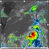
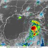
To all of those in Florida, hope you're ready for Idalia. They're saying she will make landfall tomorrow. Hoping for a minimum of damage and loss of life!
Hurricane Idalia headed for Florida
- Thread starter CanCuba
- Start date
You are using an out of date browser. It may not display this or other websites correctly.
You should upgrade or use an alternative browser.
You should upgrade or use an alternative browser.
Yes, be safe and be prepared. No shame in running either!
Yes, be safe and be prepared. No shame in running either!
Not at all! I read that a refinery mixed diesel with the gasoline and that may affect the ability of some people to evacuate in their cars. They may not even have an idea they have tainted gas until their engine dies!

As Idalia nears, Florida officals warn of 'potentially widespread' gas contamination: What to know
Florida officials are warning drivers of “potentially widespread fuel contamination” impacting gas stations across the state's west coast as residents brace for Tropical Storm Idalia’s expected landfall later this week
Last edited:
Parley
Known around here
We have a rental house in Riverview which is right outside of Tampa. Hillsborough County has a mandatory evacuation notice for those right on the coast.
bigredfish
Known around here
Right now it looks to be heading just north of Cedar Key which puts Tampa and us over in Lake County out of the cone.
All preps done over the weekend regardless, a good practice session for the season for us if nothing else. Now I have 25gal of gas treated with Stabil sitting in the shed
We'll wait till tomorrow evening to bring stuff that might fly into the sheds and house, but otherwise ready. Only real concern being on the right (dirty) side of the storm is the outer bands carrying embedded tornados. I'd almost rather face the core storm than dodge those damn things that pop up in a moments notice.
bigredfish
Known around here
Maybe just a tad smokey for the gas-fueled cars, let's hope....the other way around (gas into Diesel) could be A LOT worse.Not at all! I read that a refinery mixed diesel with the gasoline and that may affect the ability of some people to evacuate in their cars. They may not even have an idea they have tainted gas until they're engine dies!

As Idalia nears, Florida officals warn of 'potentially widespread' gas contamination: What to know
Florida officials are warning drivers of “potentially widespread fuel contamination” impacting gas stations across the state's west coast as residents brace for Tropical Storm Idalia’s expected landfall later this weekabcnews.go.com

bigredfish
Known around here
Looks like you’re getting pummeled with the first big outer band about now. I know infrastructure isn’t exactly robust there, fingers crossed you maintain what little window of power and comms you normally get.
bigredfish
Known around here
Thank you for your best wishes. We're the blue dot:

Power has come on and off a couple times already. The utility turns the power off for winds over 60km/h and the forecast isn't for more than 40km/h here in Havana.
I have a 150ah battery array hooked up to a UPS so cameras will keep recording for a couple days. But we're not expecting it to be that bad in Habana.
Those poor bastards in Pinar del Rio are still recovering from Ian last year. Very beautiful, rural area but they get nasty storms as it's basically a peninsula off the west of the island.
bigredfish
Known around here
For those playing at home or with too much time on your hands, good source is the storm2K forum where lots of amateur as well as Pro Mets hangout.
And Levi Cowans Tropical Tidbits
ATL: IDALIA - Models - Page 43 - STORM2K
www.storm2k.org
And Levi Cowans Tropical Tidbits
For those playing at home or with too much time on your hands, good source is the storm2K forum where lots of amateur as well as Pro Mets hangout.
ATL: IDALIA - Models - Page 43 - STORM2K
www.storm2k.org
And Levi Cowans Tropical Tidbits
Oh, awesome. I will definitely check those out today.
bigredfish
Known around here
Discussion
Models
Recon
ATL: IDALIA - Post-Tropical - Discussion - Page 95 - STORM2K
www.storm2k.org
Models
ATL: IDALIA - Models - Page 43 - STORM2K
www.storm2k.org
Recon
ATL: IDALIA - Recon - Page 12 - STORM2K
www.storm2k.org
fergenheimer
Getting comfortable
bigredfish
Known around here
bigredfish
Known around here
fergenheimer
Getting comfortable
It looks like most of the heavy rain was the US19 corridor. Prayers go out for those affected. Local news showed Steinhachee under water. It's expected to stay a category 2 up through Georgia. It is in Perry now. Something we don't always think about is how the storm can affect us after it passes. Florida gas compressor station is in Perry and it supplies gas to power stations south of there. Also several thousand acres of solar fields in the storm. Wonder if we will see pictures of any damage there?
All good here in NE Florida, rain with a lot of wind but nothing too crazy.
This taken from my backyard into the preserve.
View attachment windy.mp4
This taken from my backyard into the preserve.
View attachment windy.mp4


